


Trace_Le_Val

affinetataille
User GUIDE
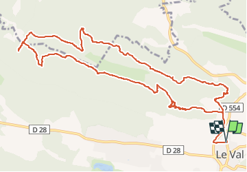

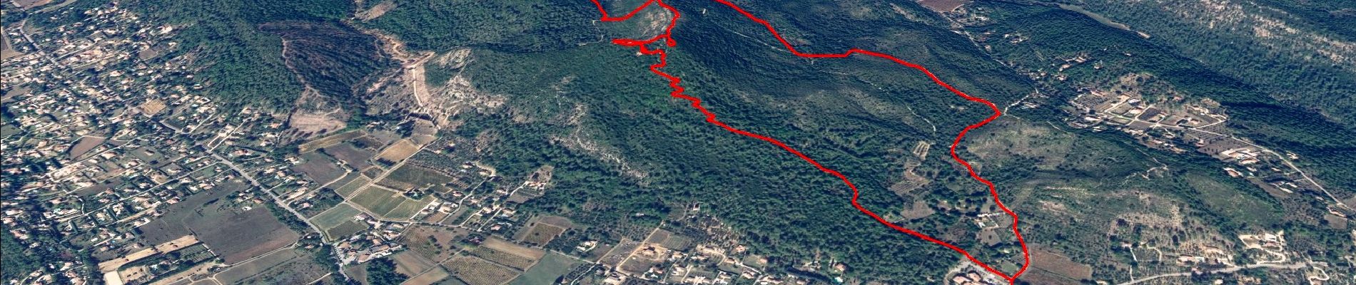
Length
14.6 km

Max alt
520 m

Uphill gradient
510 m
Km-Effort
21 km

Min alt
241 m

Downhill gradient
509 m
Boucle
Yes
Creation date :
2022-06-28 10:56:29.023
Updated on :
2022-12-23 01:41:20.892
6h00
Difficulty : Medium

FREE GPS app for hiking
 SityTrail
IGN / Geographical institutes
SityTrail Plus
The world is yours!
About
Trail Walking of 14.6 km to be discovered at Provence-Alpes-Côte d'Azur, Var, Le Val. This trail is proposed by affinetataille.
Photos


23 photos in total. Please click on a photo to see them all in the gallery.
Positioning
Country:
France
Region :
Provence-Alpes-Côte d'Azur
Department/Province :
Var
Municipality :
Le Val
Location:
Unknown
Start:(Dec)
Start:(UTM)
263090 ; 4813967 (32T) N.
Comments